According to estatelearning, Djibouti is located in the Horn of Africa, bordered by Eritrea to the north, Ethiopia to the west and south, and Somalia to the southeast. The country is situated on a peninsula that juts out into the Gulf of Aden and overlooks the Bab-el-Mandeb Strait, which is one of the busiest shipping lanes in the world. Djibouti has a coastline that stretches for 314 kilometers along the Red Sea and Gulf of Aden. The terrain consists mostly of plateaus, with some hills in the north and northwest. The climate is arid with hot summers and mild winters.
Prehistory
The study of Djibouti’s prehistory began with a French ethnographic expedition in the 1930s. Recent research has shown a possible obsidian trade between Djibouti and Egyptian dynasty.
Little was known about stone implant-using communities or early agriculture prior to American surveys in the late 1980s. Then a number of premises with rock paintings were also discovered, which were related to the development of livestock management in Djibouti.
History
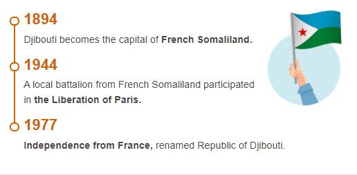
The Djibouti state formation is a result of the British-French rivalry in the Red Sea during the colonial era, initiated with the United Kingdom’s occupation of Aden in 1839. The French colony that was created in 1862-96 was renamed Côte française des Somalis, changed in 1967 to the Territoire français des Afars et des Issas. As an independent state, Djibouti has existed since 1977. To see more information other than history, please visit Abbreviationfinder to learn more about climate, population, government, and economy for the country of Djibouti.
The main industry has always been nomadic livestock management. However, the location at Bab-el-mandeb has meant that the area has been involved in coastal and caravan trade since ancient times. Politically, before the colonization, the population belonged to the periphery of the Ethiopian sphere of power.
The first French acquisition was the acquisition of the small port city of Obock in the Afarese land. In the years 1884–88, possession was extended with a coastal strip around the Tadjour Gulf up to the border with British Somaliland. In 1888, the new port of Djibouti was established, which became the capital in 1892. The colony’s creator and first governor, Léonce Lagarde, established good relations with Ethiopia. The boundary was established in 1897, and at the same time agreements were reached on rail construction for Addis Ababa and Ethiopia’s utilization of the port. Port and rail revenues became the foundation of Djibouti’s economy.
After the Second World War, the colony was granted some autonomy, and in the 1960s the formation of an independent state began to be debated. The demands came mainly from groups of issa, which dominated the eastern part of the colony with the port city of Djibouti. Not only did they feel an ethnic-linguistic affiliation with the Somalis in the east; Djibouti was close to the border and the living opportunities offered there attracted immigrants from the east. Afar remained a predominantly nomadic nation with strong ties to the Afar population in Ethiopia.
- Countryaah: Check to see the location of Djibouti on the world map. Also covers major mountains, rivers and lakes in Djibouti.
A first vote on independence was held in 1967. However, France retained its supremacy. The name of the colony was changed to the Territoire française des Afars et des Issas, a recognition of the equality of the two peoples. A joint party for independence was formed and ten years after the first vote, in May 1977, independence came. Issa politician Hassan Gouled, who led the independence movement, became the first president of the republic. He quickly formed his own party and in 1981 won the first presidential election by a large majority. During the 1980s, Gouled was able to keep tensions under control from time to time, but in 1989 unrest broke out with ethnic signs in Tajura and then in the capital. An armed African resistance movement called the Front pour la Restoration of the Unity and the Democracy(FRUD) occasionally dominated large areas in the northern part of the country. After a peace agreement in 1994, FRUD was recognized as a political party in 1996 and then began to approach the government side politically.
Gouled resigned in 1999 and was succeeded by his mother-in-law and adviser Ismail Omar Guelleh. He won the 1999 and 2005 presidential elections, and since the constitution was amended to allow additional terms of office, Guelleh was re-elected in 2011 and 2016.
Djibouti pursues an active foreign policy with the primary purpose of promoting cooperation on the Horn of Africa. The Regional Cooperation Organization Intergovernmental Authority on Development (IGAD) has its permanent secretariat in Djibouti. However, Guelleh’s attempt to mediate in Somalia led to tense relations with the state of Somaliland in the early 2000s. Following the terrorist attacks in the United States in September 2001, Djibouti joined the US in the “war on terrorism”. The US has been allowed to establish a military base for the surveillance of suspected terrorists in East Africa and around the Red Sea.
In early 2011, thousands of protesters demanded Guelleh’s departure since the popular protests in North Africa spread to Djibouti. However, the demonstrations were turned down by the police. The drought disaster that hit the Horn of Africa in 2010-11 led to famine in Djibouti as well.
Even after the 2013 parliamentary elections, street protests erupted since Guelleh-controlled party alliance Union pour la Majorité presidential (UMP) regained its own majority. However, the opposition gained greater representation than ever in Parliament through the newly formed alliance Union pour le salut national (USN). However, this split during the period leading up to the 2018 elections and the UMP seized 57 out of 65 seats.